
Buckle up for some really wild weather over the next few days.
Storm Ciaran is due to hit the UK on Wednesday night and into Thursday, bringing very high winds and a lot more rain.
The storm has been seeded by huge temperature extremes over North America. Canada is below freezing, while southern California is basking in highs over 30C.
That’s whipping up the high-altitude winds of the jet stream to around 200mph. And in there is the kernel of Ciaran racing across the Atlantic.
On Wednesday, the storm is forecast to break away from the jet stream and barrel directly towards the UK, with the air pressure at its centre dropping rapidly – perhaps so low that it breaks the record for a November storm – 948.4mb, set in 1954.
The lower the air pressure, the stronger the winds, with the highest speeds expected on the southern edge of the storm system.
Weather near you:
Check the forecast in your area

The village of Collingham in Nottinghamshire was flooded in October
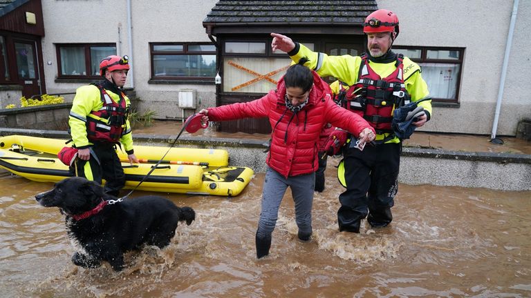
Members of the emergency services help a woman in Brechin in October
The Met Office has issued an amber weather warning for Pembrokeshire, Cornwall and Devon between 3am and 1pm on Thursday, and the Channel coast from Dorset to Kent between 6am and 8pm.
Wind speeds could be 70 to 80mph on the coast, possibly exceeding 85mph in exposed spots.
That’s enough to cause significant damage to property, with debris being hurled through the air.
Trees will also take a battering because they are still in full leaf. And transport will be disrupted.
If the storm follows the current predicted track, the high winds only really clip the southern coast of the UK.
But they are far worse over the Channel Islands and northern France.
A northward shift of the storm by just 50 miles could significantly increase the impact to the UK. So stay tuned.
Read more:
The areas due to be hit by storm this week
Woman found dead in floods by son named